Mount Batur Trekking Map – Mount Batur is most likely mountain visited by hikers in Bali for capture sunrise. This is the only one an active stratovolcano Bali till today. The most hikers visit this volcano for Mount Batur sunrise trekking but some hikers trek for Mount Batur day trekking, Mount Batur Sunset Trekking or Mount Batur overnight camping. Trek to Mount Batur should be hiring a guide because Bali government role said every hiker who hike mount Batur must take a guide because hire a guide to be safe from hike although the mountain is a fairly straightforward two hours hike only.
Mount Batur Trekking Map
Despite this mountain easy but to know the right map is the best way before head up, here bellow I attached photo of Mount Batur trekking map or mount Batur sunrise Trekking maps to complete your knowledge before head up.
Mount Batur Sunrise Trekking Map
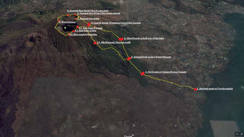
1. Starting point from Toyabungkah
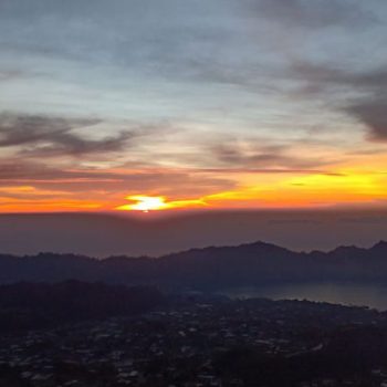
This is the best starting point for your mount Batur sunrise trekking, the coordinate of maps you can click this -8.249872, 115.397523. Your will start from here between 3.45 am to 4.00 am then hike up to the summit 2 hours, you will reach the summit before 6.00 am and sunrise will be 6.15 to 6.30 am.
2. Fist break at Tampuryang Temple
This is the first most hiker do, precisely nearby holy place called Tampurhyang temple, from starting point to this temple take around 20 minute, here you will feel warm and time to take out your jacket and drink water, the coordinate at bellow -8.247971, 115.391971.
3. Second break at Jero Wage Warung
This is the second break after take about 40 minutes from starting point, some strong hikers here the fist break but most hikes do second break here, here will be feel hot and here also you can choose hike to the summit or to the rim crater only, if you strong to the summit recommended one, the coordinate map as bellow -8.242468, 115.387764.
4. Third break half way half
This is on the half way half of the mountain, from this place is most challenging till the summit, you will walk on the rock and steep terrine, the coordinate of this break as bellow -8.238936, 115.385697.
5. The fourth break Nyangleg
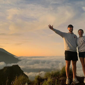
This is 20 minutes before the summit, it called Nyangleg break point, from this place the trail will be getting easier until the summit, from here you can see amazing views of Lake Batur and also Mount Abang and Mount Agung, the coordinate maps as bellow -8.238171, 115.381473.
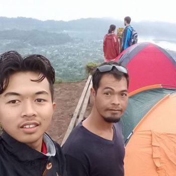
6. The summit Jero Wage ( Hot Steam Place)
This is the summit of Jero Wage, most hiker come to the summit because from here you can stunning amazing sunrise and also experiences how your guide cooked the egg or your breakfast on the steam. Beside of that, here the pace where your guide will served you yummy breakfast, hot drink and also some fruits, the coordinate is -8.236318, 115.378503.
7. Summit Jero Salin
This is the busies summit on mount Batur because all hiker who good physical fitness and they start from Pura Jati come to this summit, here also can see amazing views as well as from Jero Wage Summit but the minus from this summit is Hot Steam, in this summit not available hot steam where guide boiled Egg or banana in the ground (volcanic steam) the coordinate is -8.238360, 115.379112.
8. Summit Kaja Kauh
If you looking for less tourist you can ask your guide go to this summit, it take only 5 minute from summit Jero Wage, the view from here still beautiful too, same as from Jero Salin or Jero Wage summit, the plus value is less tourist in this summit, the coordinate is -8.236782, 115.377469.
9. West Summit.
This is another summit you can visit during your trip on mount Batur, the sunrise from here not very good because blocked by Jero Salin summit but you can see amazing views entire Batur caldera from here during surrounding the main crater, the view absolutely amazing, the coordinate as bellow -8.239099, 115.376275.
10. Summit Nang Dip
This fist summit if you start hike via Pura Jati, precisely on the rim bellow of Main carter, this summit bellow around 200 M from the actual summit from start from Toyabungkah, the view not as good as from actual summit but this summit suitable from whom feel not good fitness go to the actual summit, the coordinate as bellow -8.241904, 115.378441.
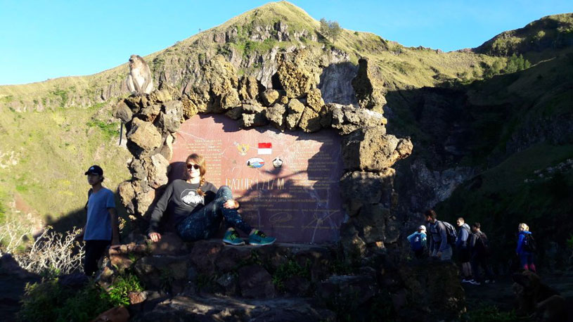
11. Rim of Main crater.
This is the rim of the main crater of Batur volcano, this will be visit after surrounding the main carter, here you can see the button of the crater and also you can feed wild monkey here. Beside of that, you can make group picture as here very wide flat area. the coordinate is -8.240949, 115.378988.
12. Jero Wan Warung.
This is Jero Wan Warung, you can stay here before descent to the car park, some hiker also stay here for sunrise but sunrise from this place not as beautiful as from the actual summit but still okay for selfie. You can have tea, coffee. noodles or other food here because Jero Wan provide it, the coordinate is -8.240576, 115.379664.
13. Alit Warung
This is the last break point during your decent, called break point Alit Warung, if you tired you can break here for couple of minute or more and also you ca have some energy food or drink as well, from here to the car park take 45 minutes more but the descent trail will be easy and walk under pine and eucalyptus trees, the coordinate is -8.241849, 115.382583.
That all about Mount Batur Trekking map or Mount Batur sunrise trekking map that I can describe, I hope by this article everyone can understand and know where they will go during their trip to mount Batur, last word thank you very much.
RATE 55 USD per pax
Note: Tour minimal 2 person